 Vanderburgh County INGenWeb
Part of the InGenWeb & USGenWeb Projects
Part of the InGenWeb & USGenWeb Projects
Online Map and Coordinates for this Cemetery:
UTM 16 450835E 4201429N
If you have any further information on "occupants" in this cemetery, please send it in.
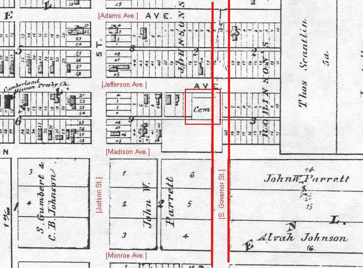
From Griffing's Atlas of Vanderburgh County, Indiana.
Other Resources
Griffing's Atlas of Vanderburgh County, Indiana : From Actual
Surveys Under the Direction of B. N. Griffing. An Illustrated Plat
Book of Vanderburgh and Warrick Counties, Indiana. Evansville, Ind.:
Unigraphic, 1975. (Reprint. Originally Published: Philadelphia:
D.J. Lake & Co., 1880 (1st work) ; Evansville, Ind.: Tillman & Fuller
Publishing Co. (2nd work).
"Old Cemeteries Often Disappear." Evansville Courier & Press 20 February
2000.
Tenbarge, Eleanor Glenn. Early Death Records, Evansville, Vanderburgh
County, Indiana As Early As 1818, Through 1883; Includes Civil War Soldier's
Burials. Evansville, Ind.: E.G. Tenbarge, 1990.