Home
Bible Records
Biographies
Boone Co Genealogy News
Cemeteries & Burials
Church Histories
Comments & Success
Databases
Deaths
Directories
Family Trees
Genealogy Homepages
Genealogy Tips
Grandma's Kitchen
History - Town/County
Land Records & Maps
Marriages
Memorabilia
Message Boards
Military
Newspaper Items
Newspapers Index
The Decade Was ...
Obituaries
Photograph Gallery
Research Resources
Surname Registry
Query Archives
Wills & Probate |
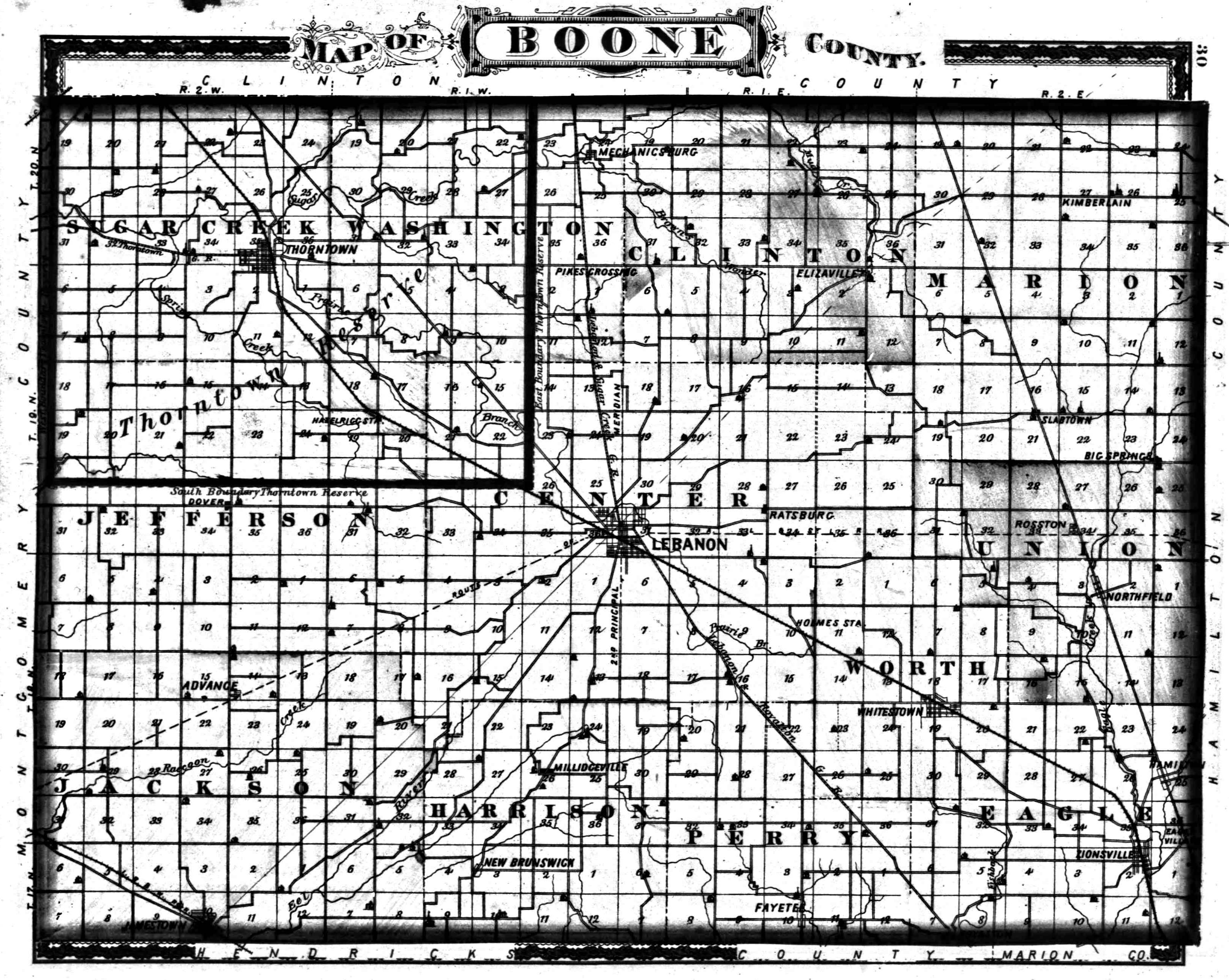
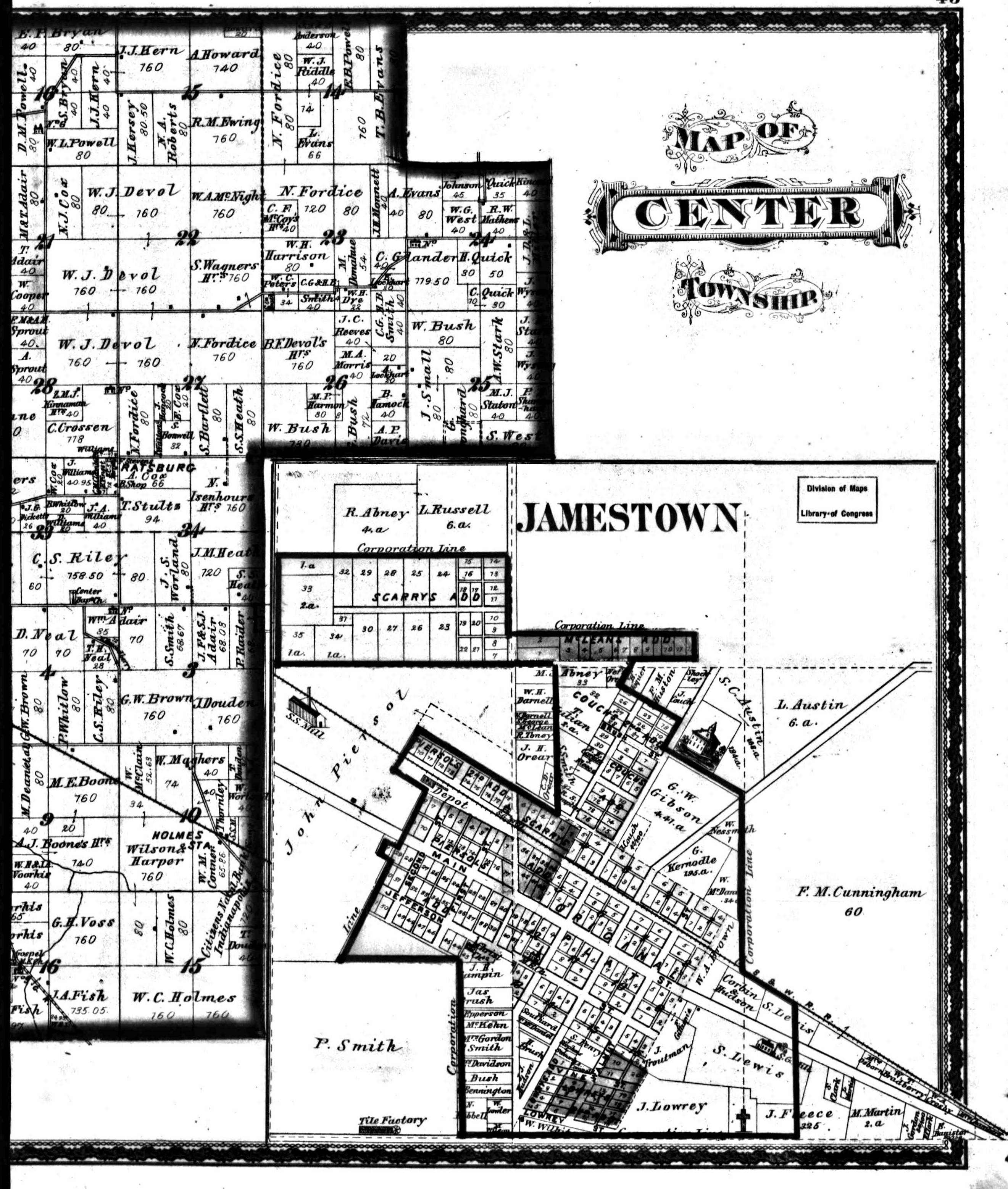
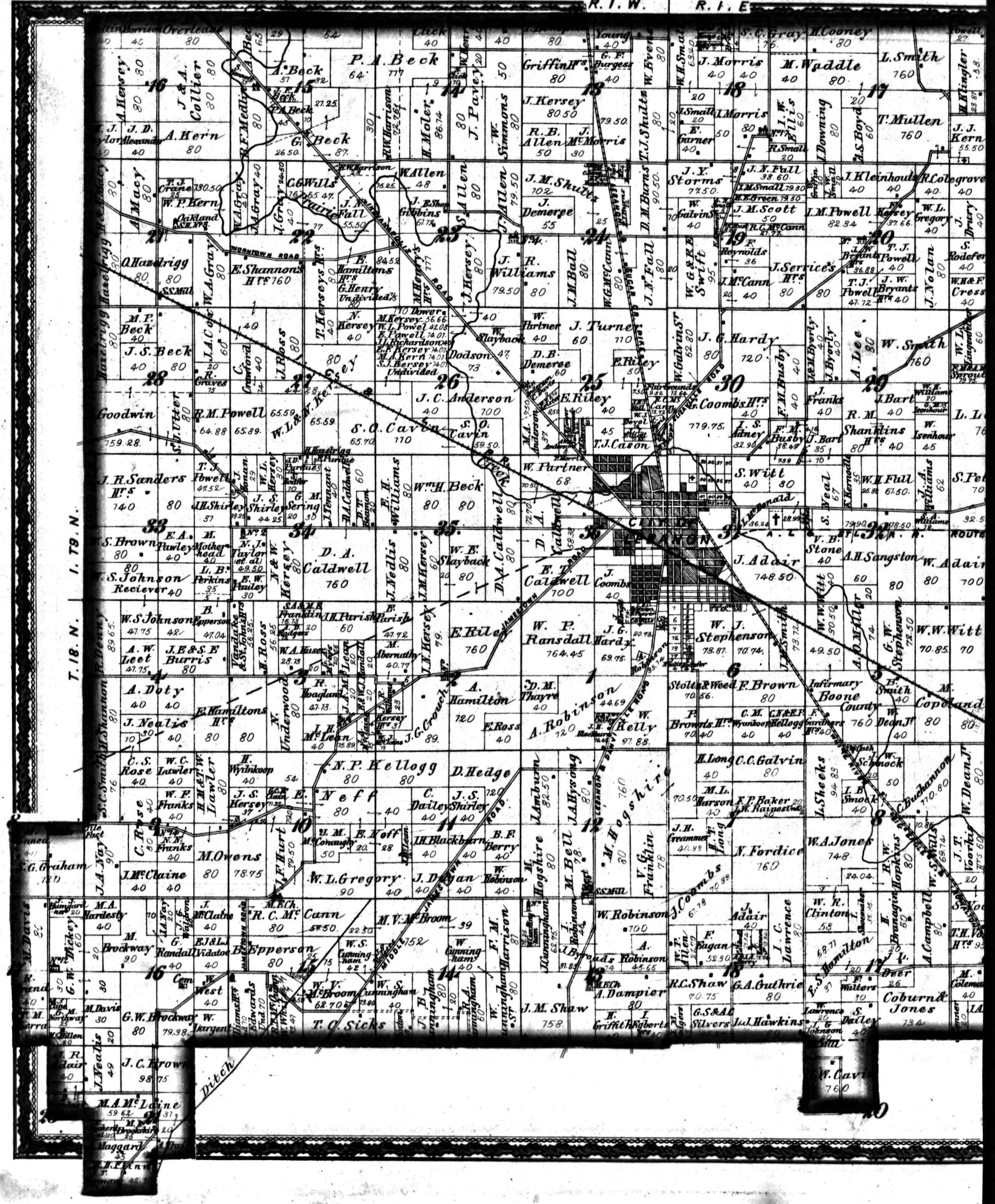
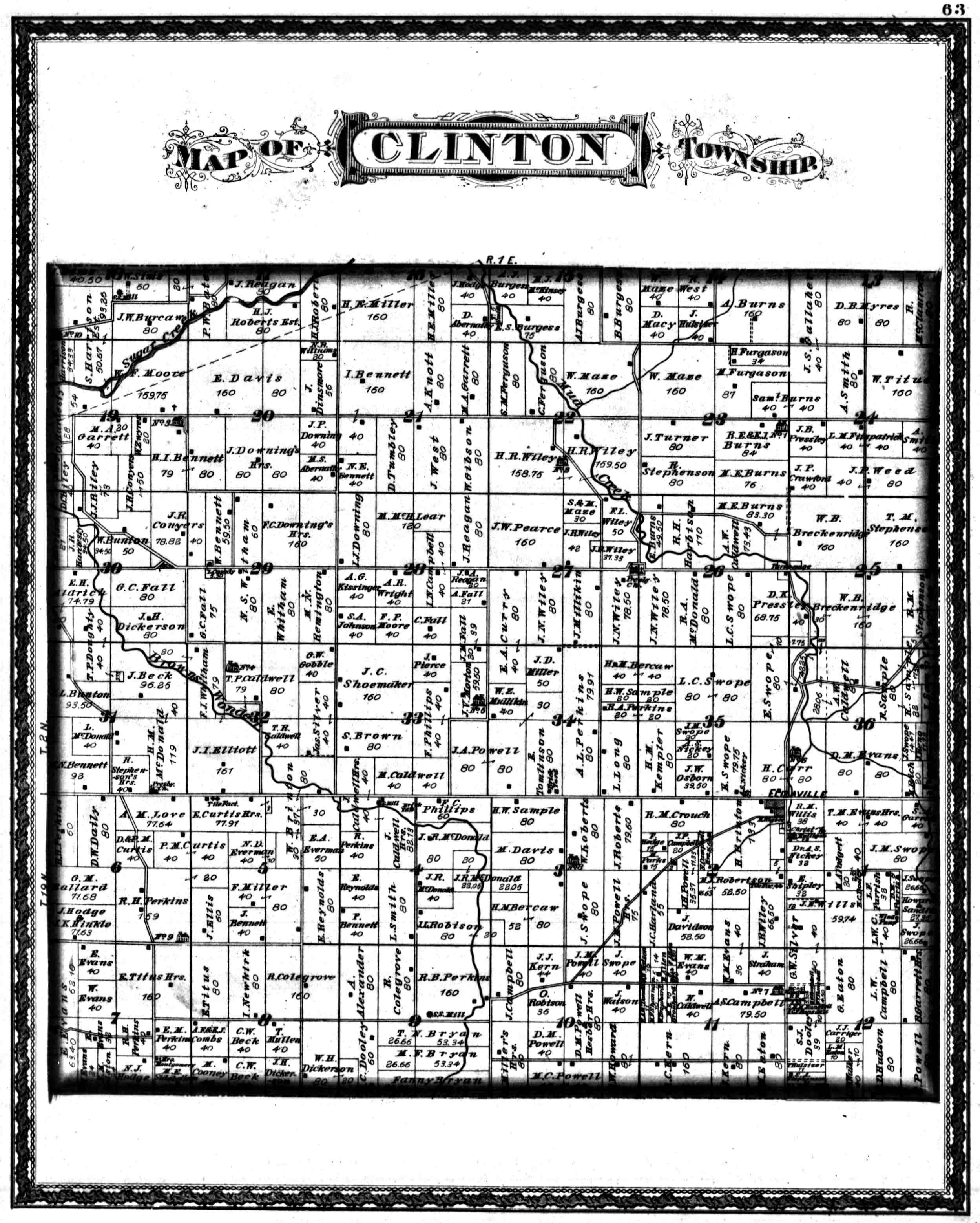
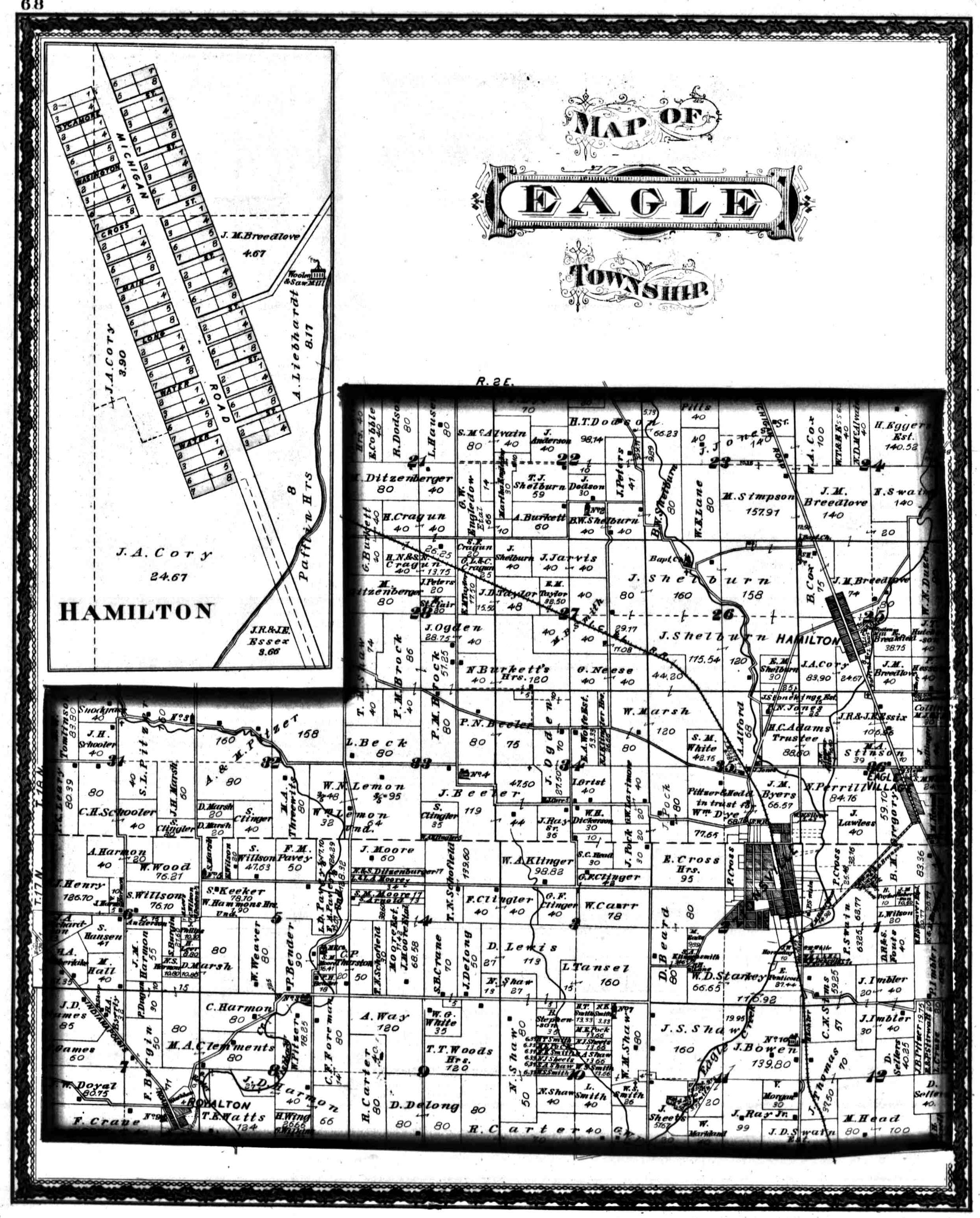
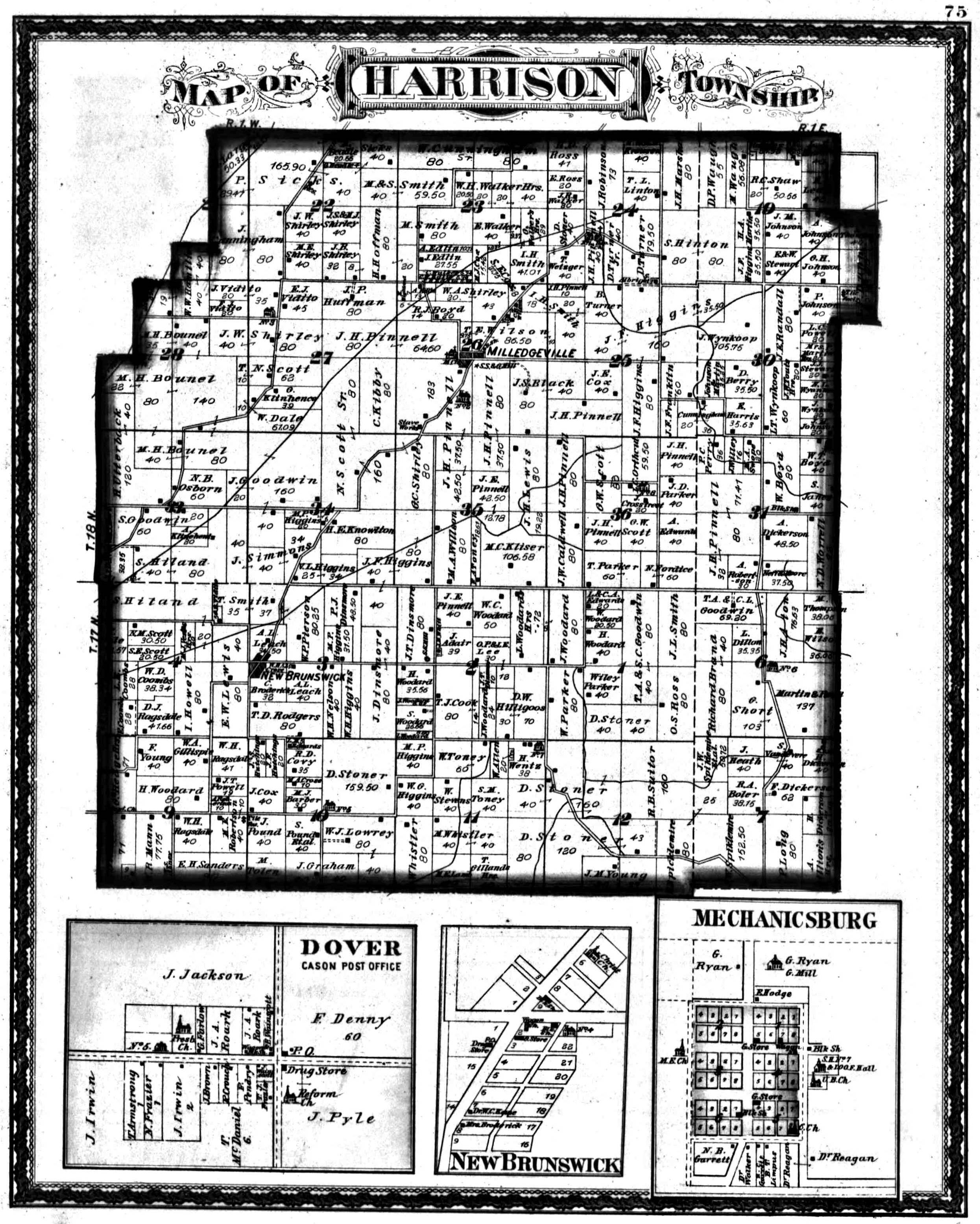
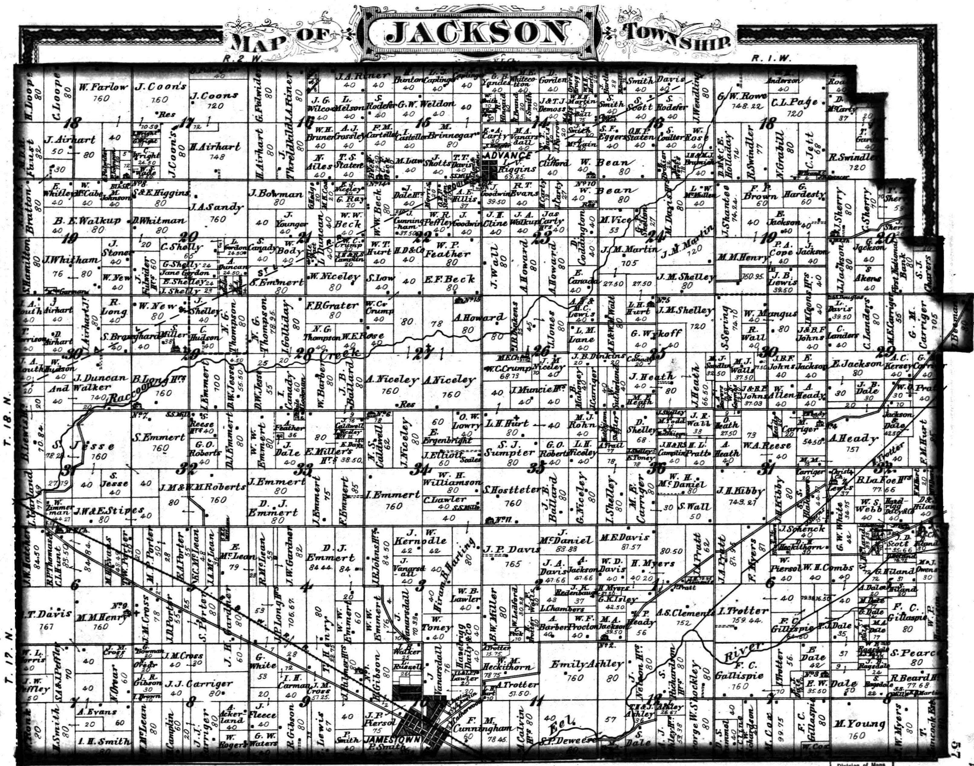
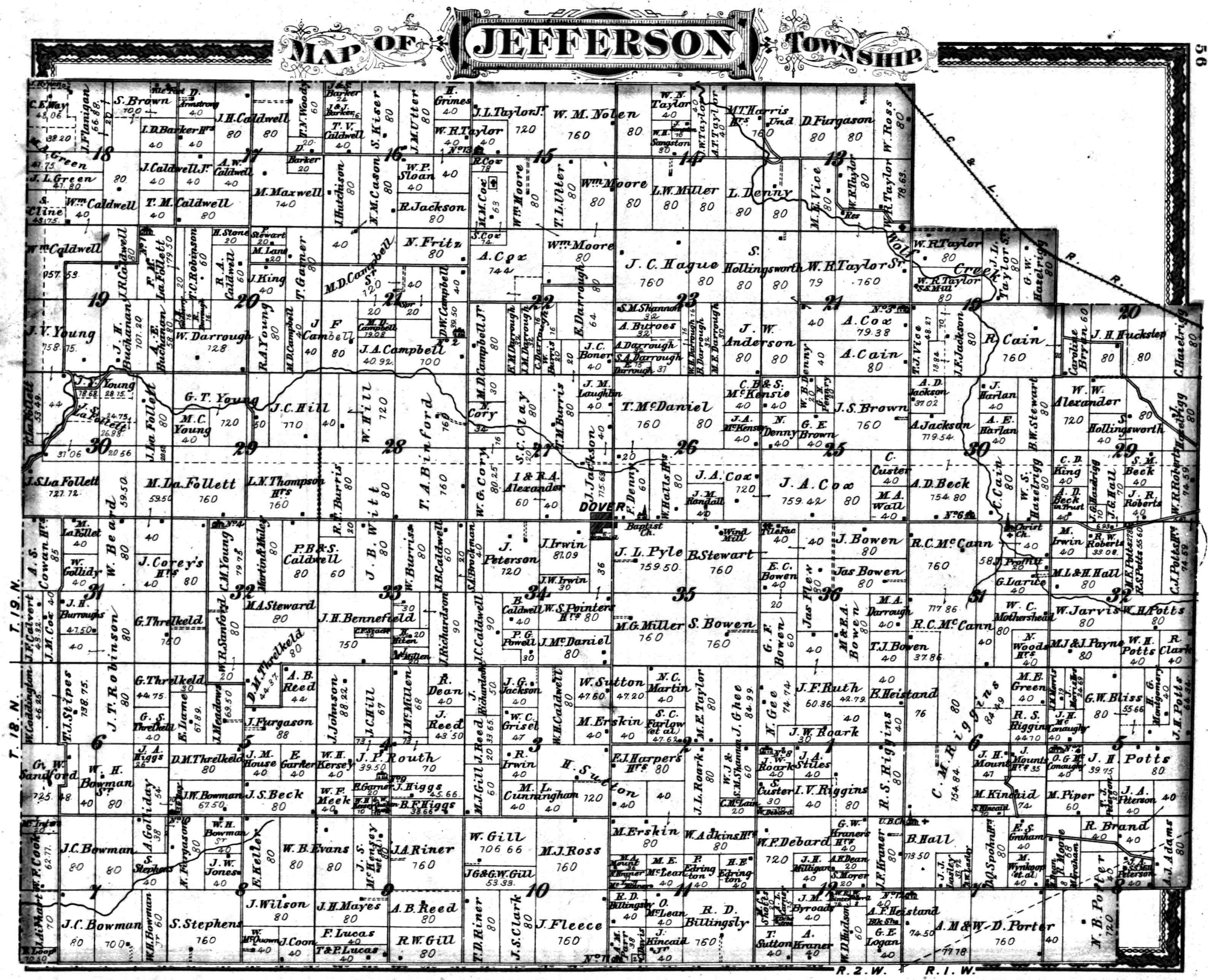
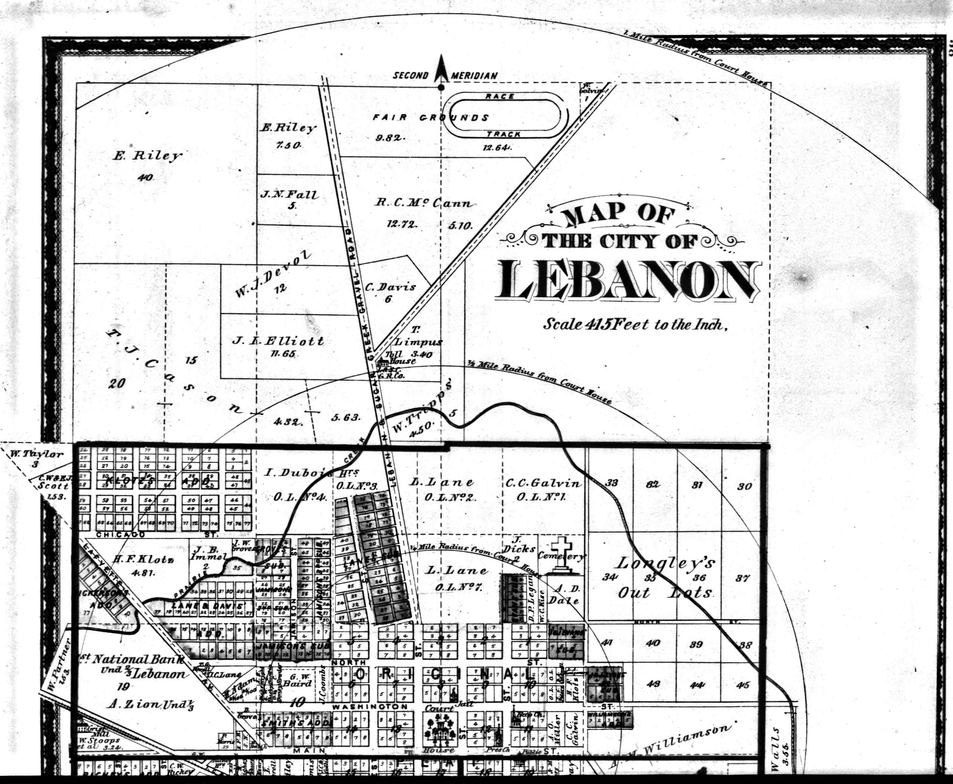
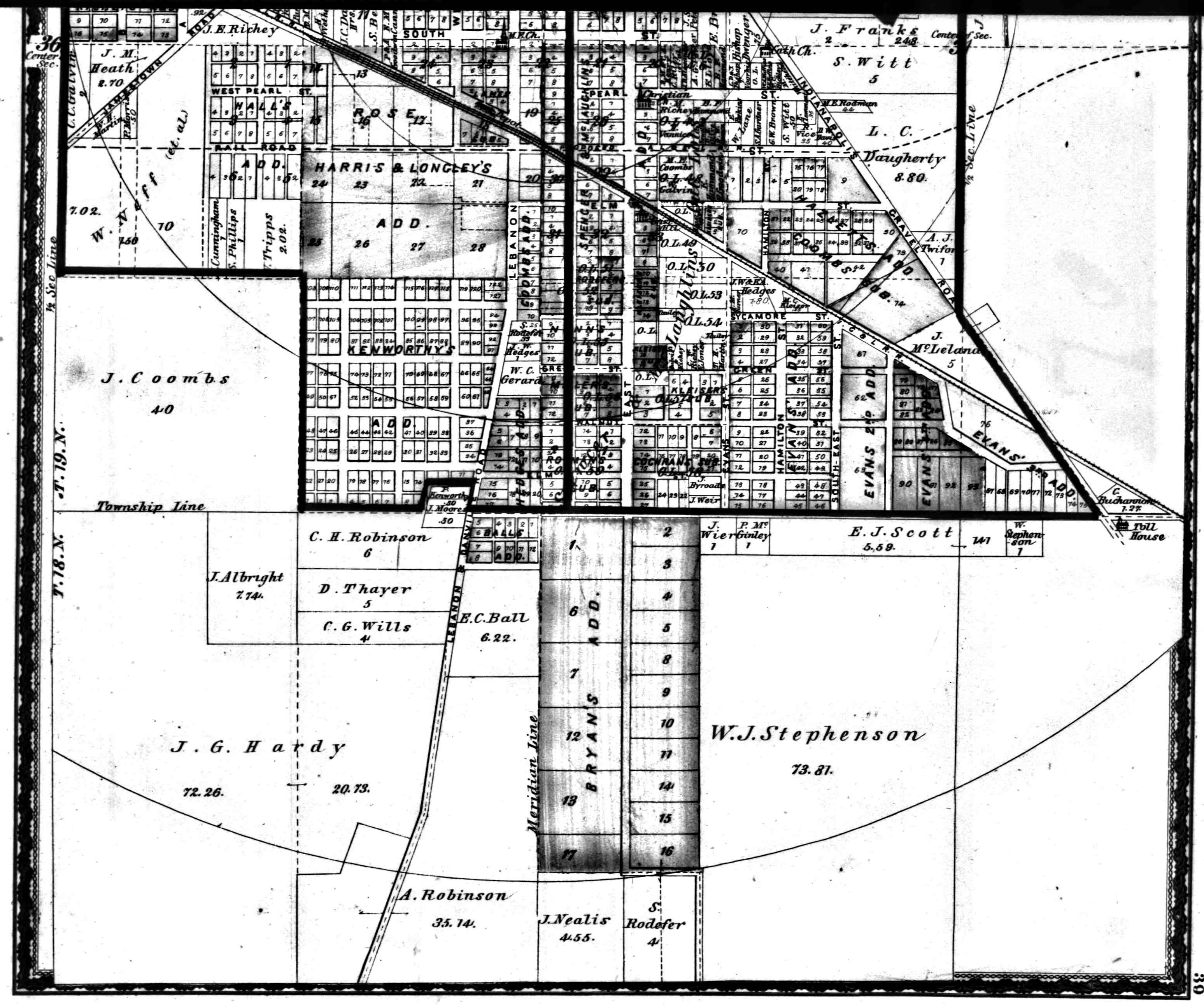
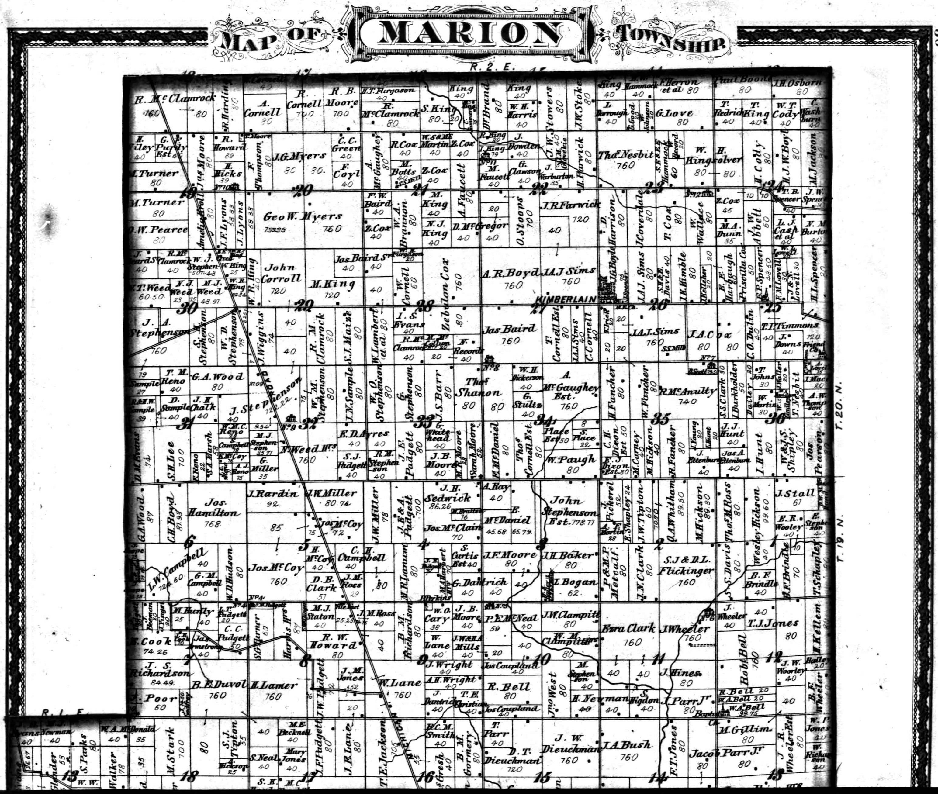
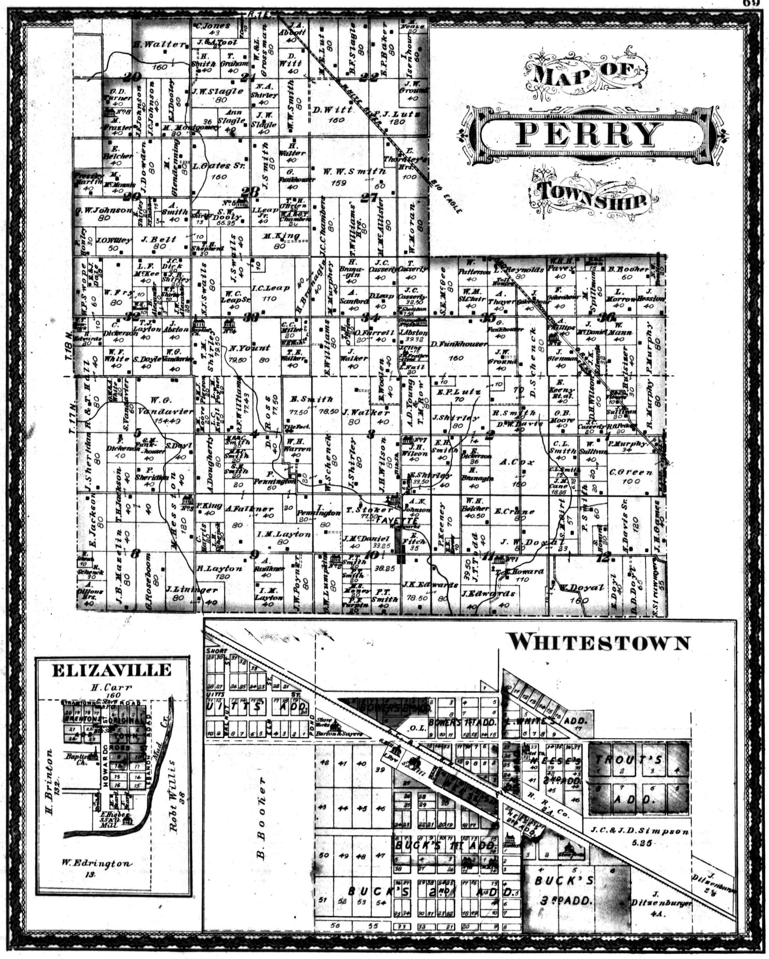
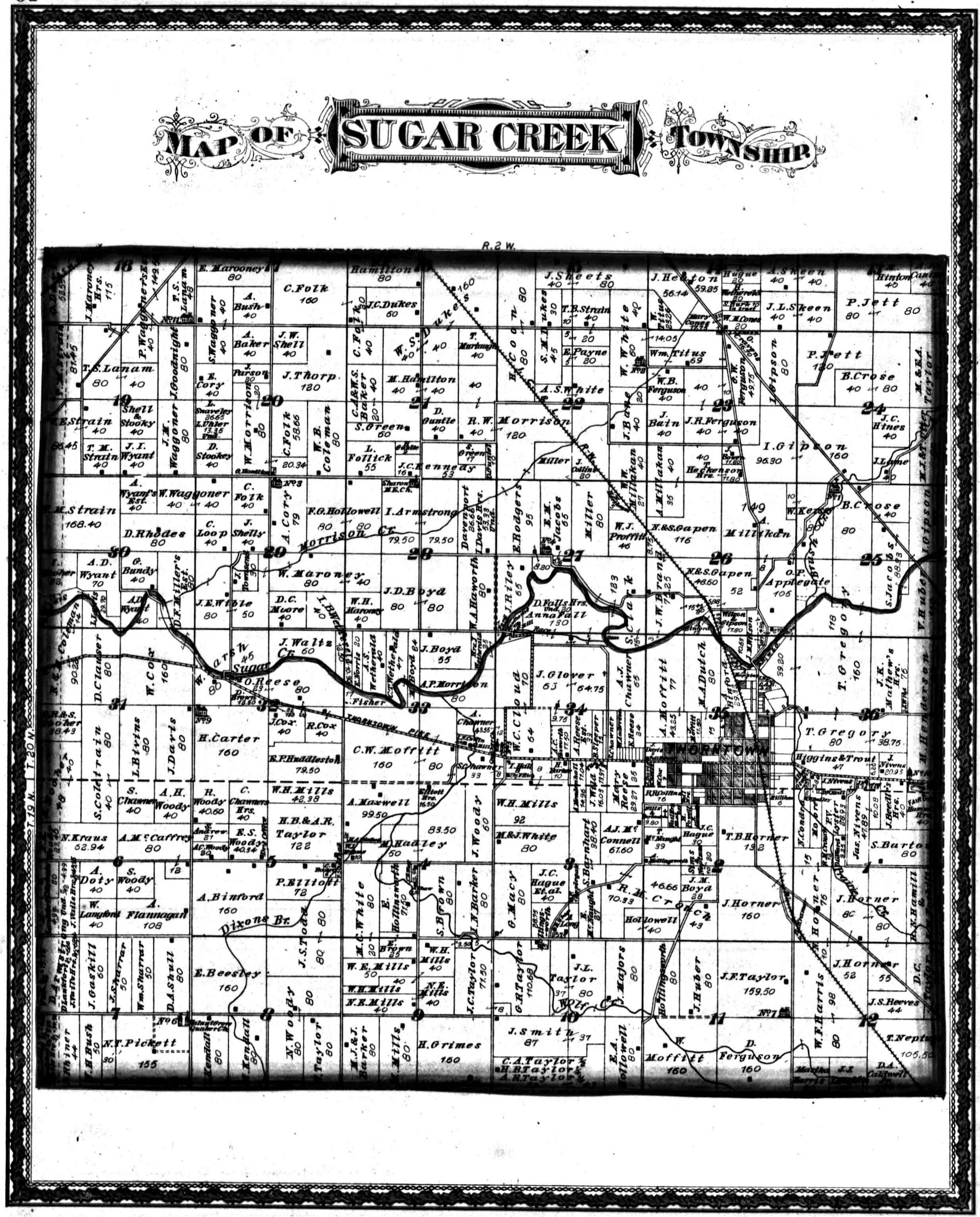
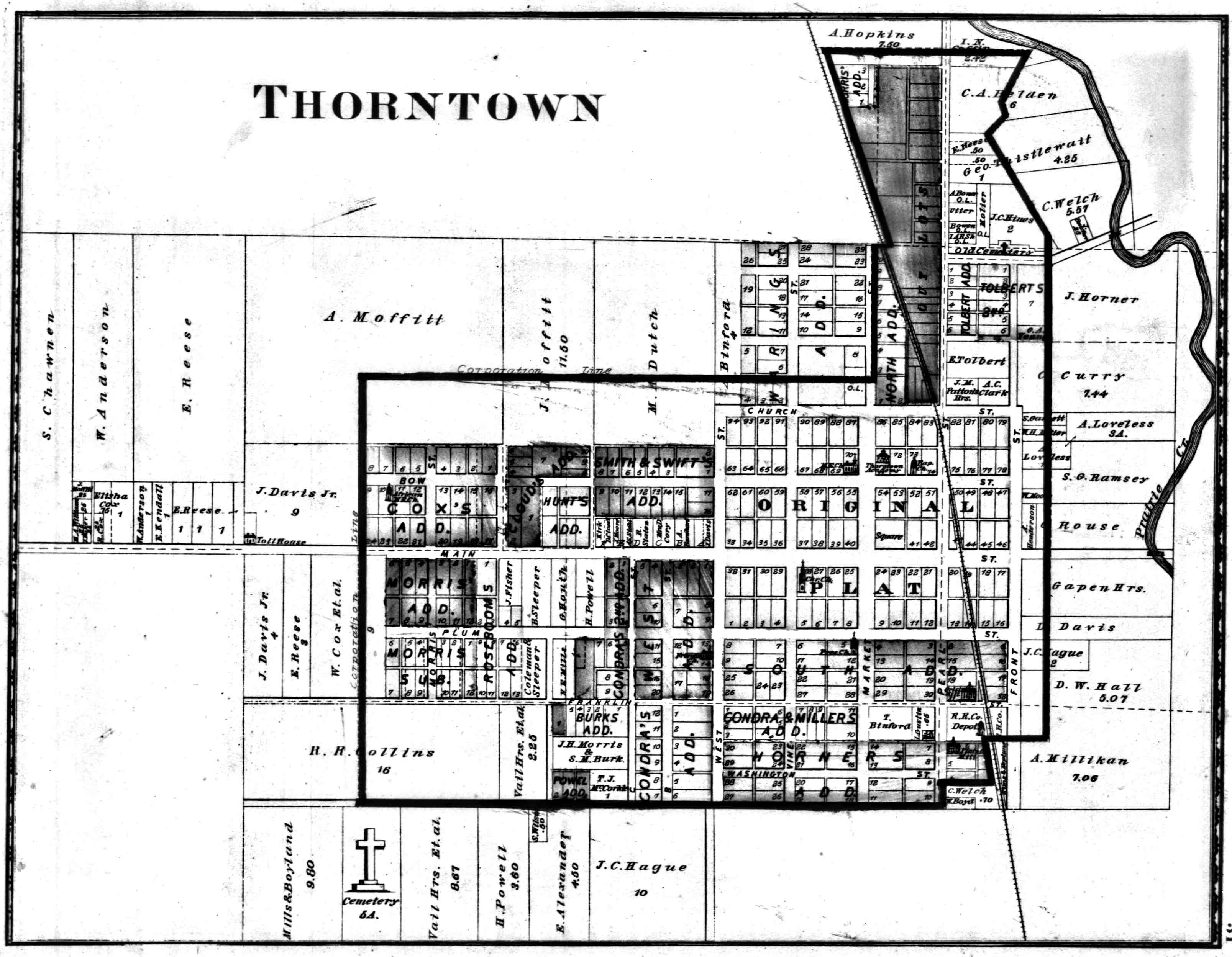
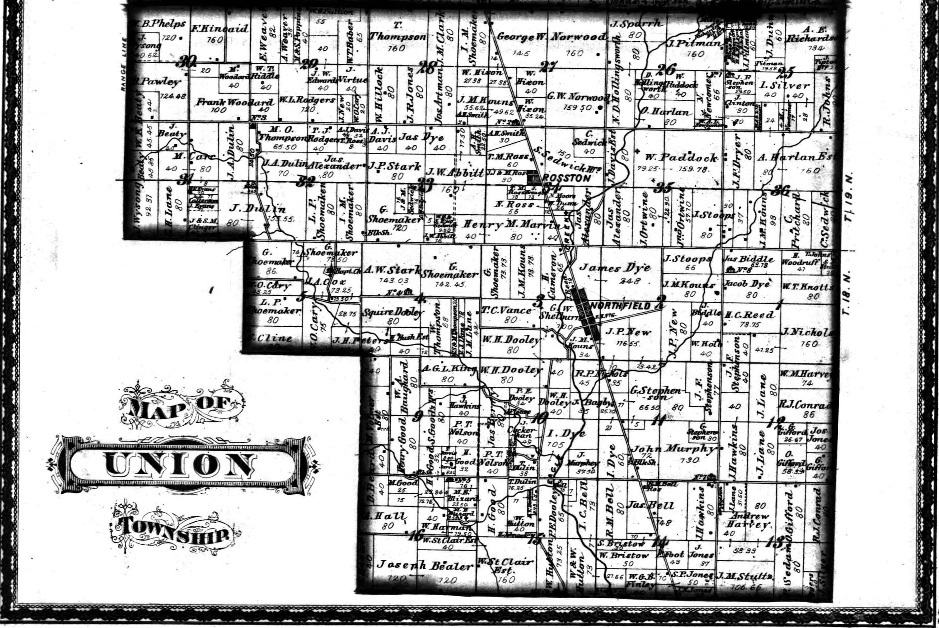
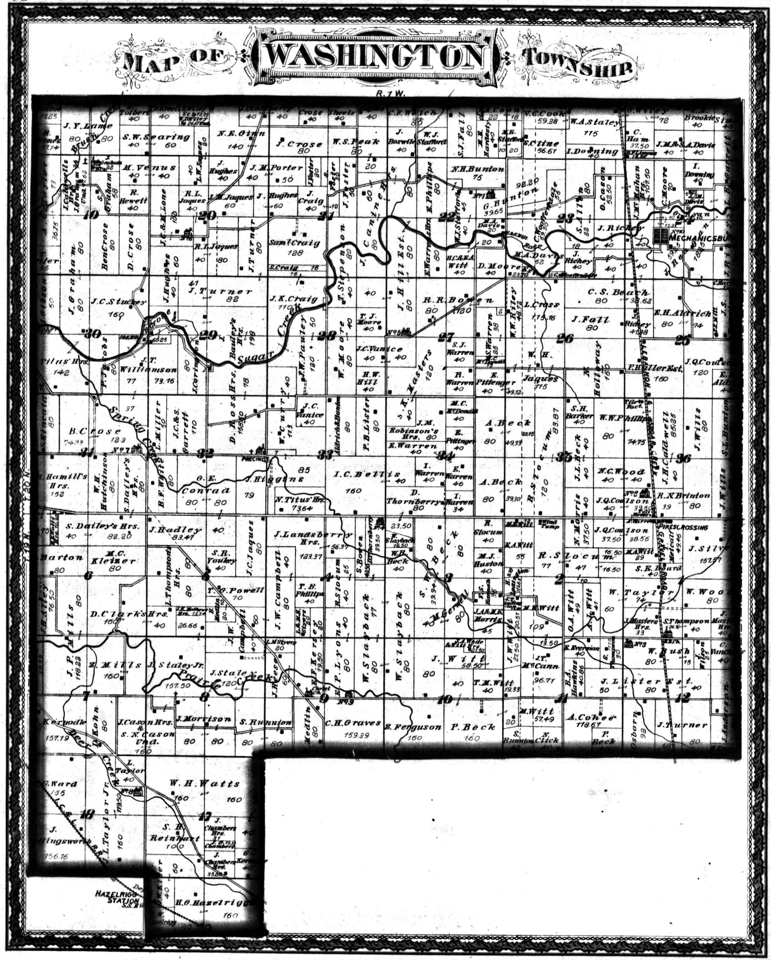
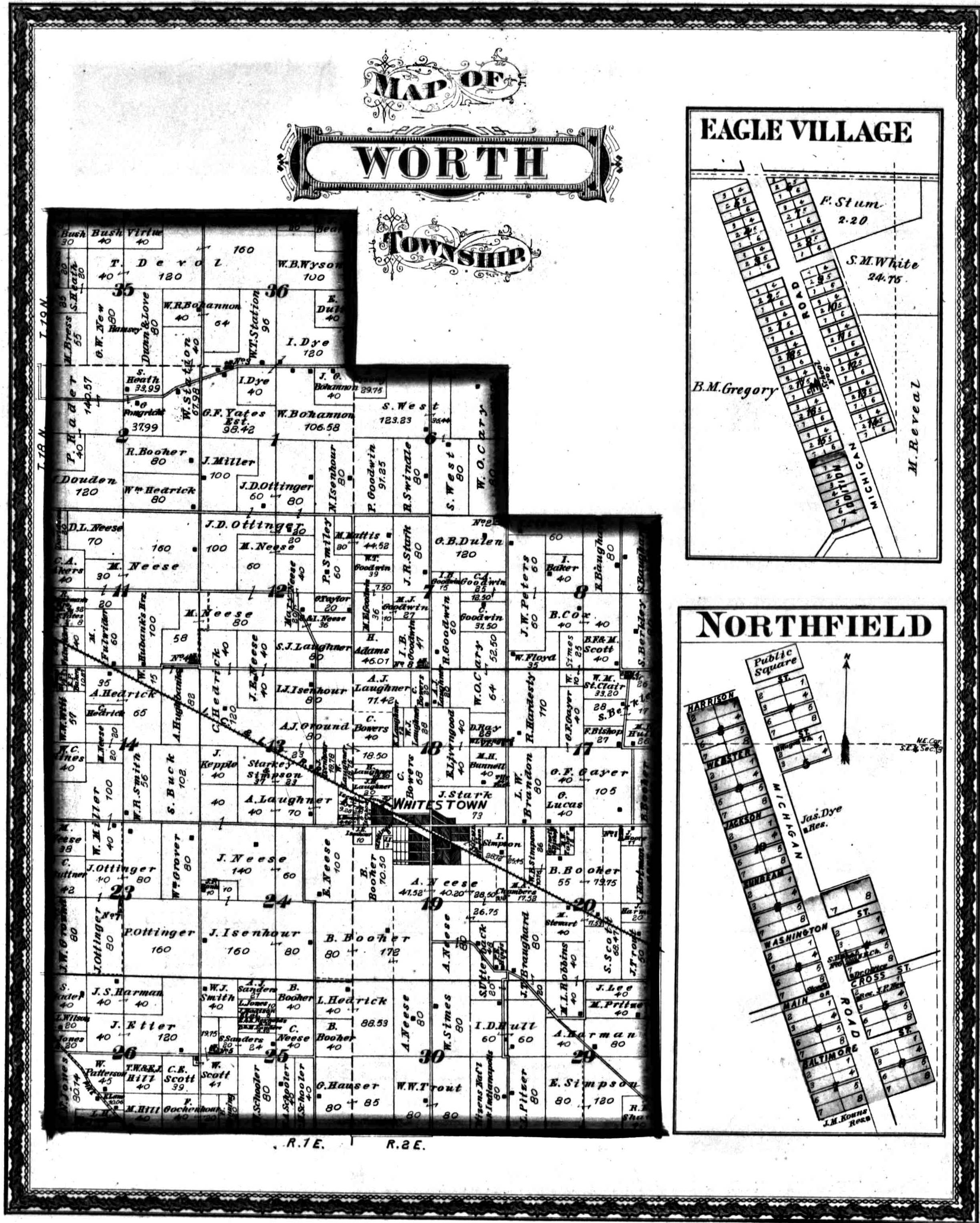
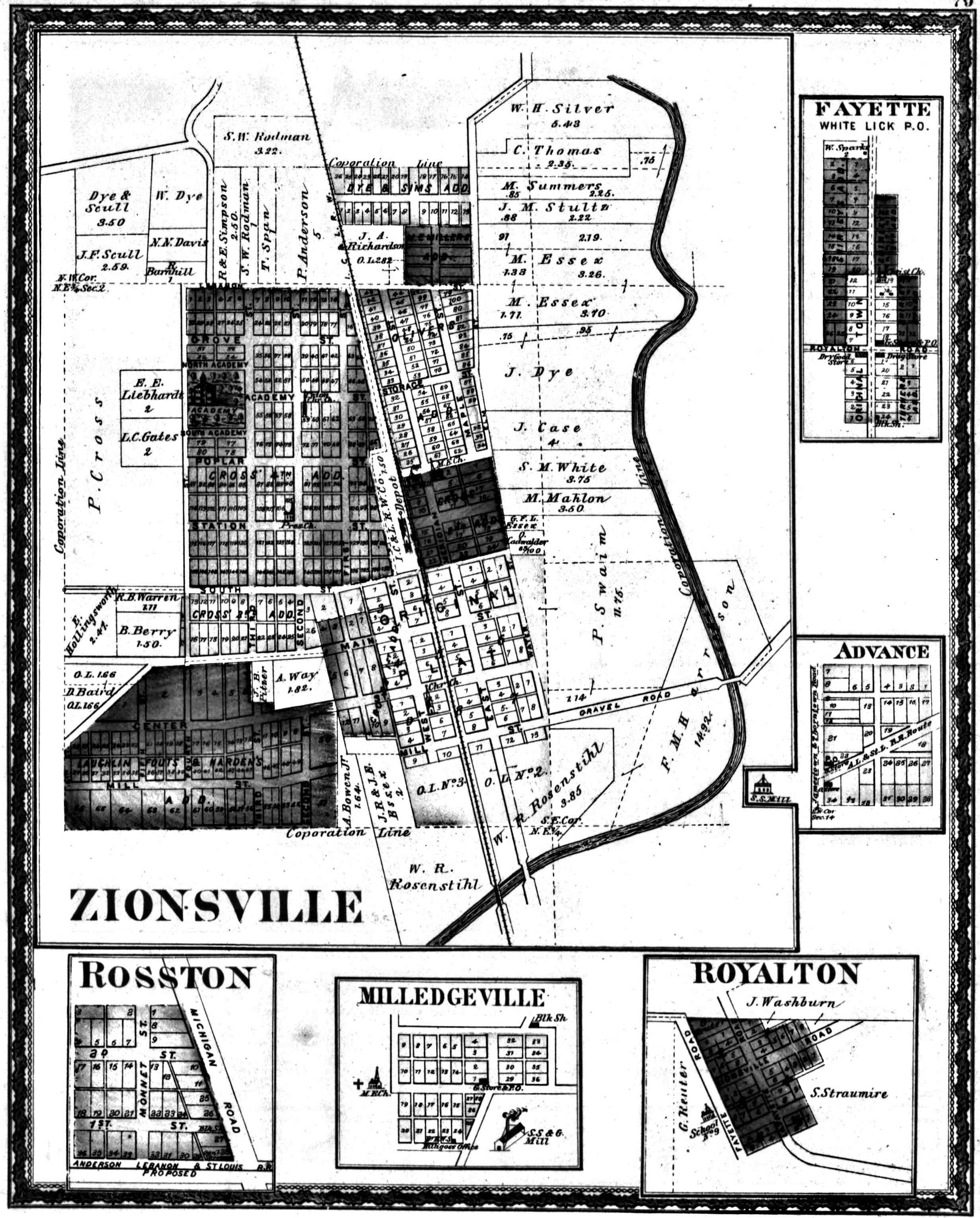
Boone County Land Ownership Atlas - 1878
This database is a portion of the landownership atlas,
"The Combination Atlas Map of Boone County, Indiana,"
for the year 1878. Land ownership maps are portrayals of
land purchased, granted, or inherited. This is primarily a
detailed Boone County atlas showing every landowner, in each
township, at the time of compilation in 1878, and a very
valuable research tool for Boone County genealogy!
Click on image to enlarge
Source Citation:
"Boone County Land Ownership Atlas - 1878," [online
data] Boone County Genealogy, INGenWeb, 2007.
<http://www.rootsweb.com/~inboone> Original data:
"Combination Atlas Map of Boone County Indiana: Compiled,
Drawn and Published from Personal Examinations and Surveys
By Kingman Brothers." Kokomo, Indiana. 1878. Microfilmed
by IUPUI University Library, Historic Indiana Atlases
Collection.
|