Return to map index
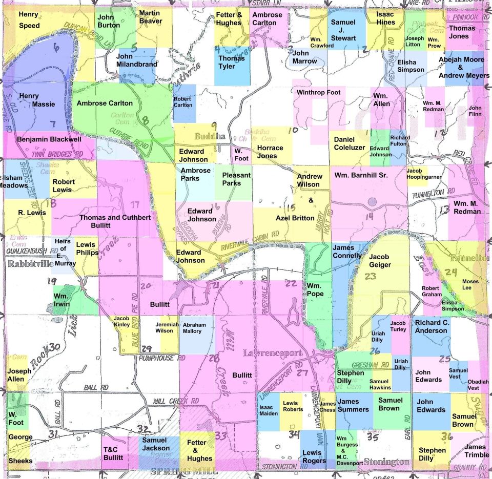
Spring Mill State Park area. Old towns of Buddha, Lawrenceport, Tunnelton and Pinhook. These towns died down with the use of the RR. Pinhook was a popular town during Prohibition. You could buy a pinhook and get a bottle of whiskey free (since they couldn't sell the whiskey!). Hence the name of the town.
The old Palestine Court House sat on land donated to the county by the Blackwells and Henry Massie. Palestine was in the corner where 5N/1W, 5N/1E, 4N/1W and 4N/1E meet. The 2nd principal meridian and a river ran through it. Every board, nail, door and window, and even the bricks from the foundation of the old court house were auctioned off and almost everyone relinquished their land in Palestine to get an equal lot in Bedford free of charge.
One of the people who didn't relinquish their land was Ezekial Blackwell. His land was in 4N/1W secton 12, adjacent to his brother Benjamin's land in 4N/1E section 7. He owned the ferry that took everyone across the river and into Bedford. There is no bridge!
| R2W | R1W | R1E | R2E | ||
|---|---|---|---|---|---|
| T6 | 6N/2W Popcorn Springville | 6N/1W Avoca Needmore Coveyville | 6N/1E Bartlettsville Heltonville | 6N/2E Zelma | T6 |
| T5 | 5N/2W Silverville Fayetteville | 5N/1W Oolitic Bedford | 5N/1E Shawswick Leatherwood Pinhook | 5N/2E Leesville | T5 |
| T4 | 4N/2W Indian Springs Williams | 4N/1W Hartleyville Bryantsville Mitchell | 4N/1E Buddha Lawrenceport Pinhook | 4N/2E Ft. Ritner Tunnelton Bono | T4 |
| T3 | 3N/2W Moorestown | 3N/1W Georgia | 3N/1E Spring Mill State Park | 3N/2E Scenic Hills | T3 |
| R2W | R1W | R1E | R2E |

Return to map index