
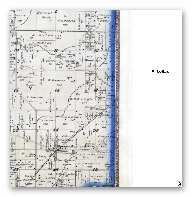
1878 plat map
1878 plat map. The cluster with the White/Dunkard Baptist Church, the Bowers cemetery and the first Bowers consolidated school was at that S curve on the Linden-Colfax Road. I would estimate it to be 3 -3 1/2 miles west of Colfax.. (MEF) – Dan Dunbar added that the Bowers Cemetery is about ¼ mile north of 850E and 1050N to help ya’ find this better! Thanks Martha, Dan & all for the help!