Use in conjunction with our on line listings & graphs

| Map
study and research continue: Sharon Snow and I are comparing the
old
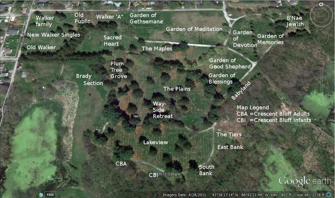
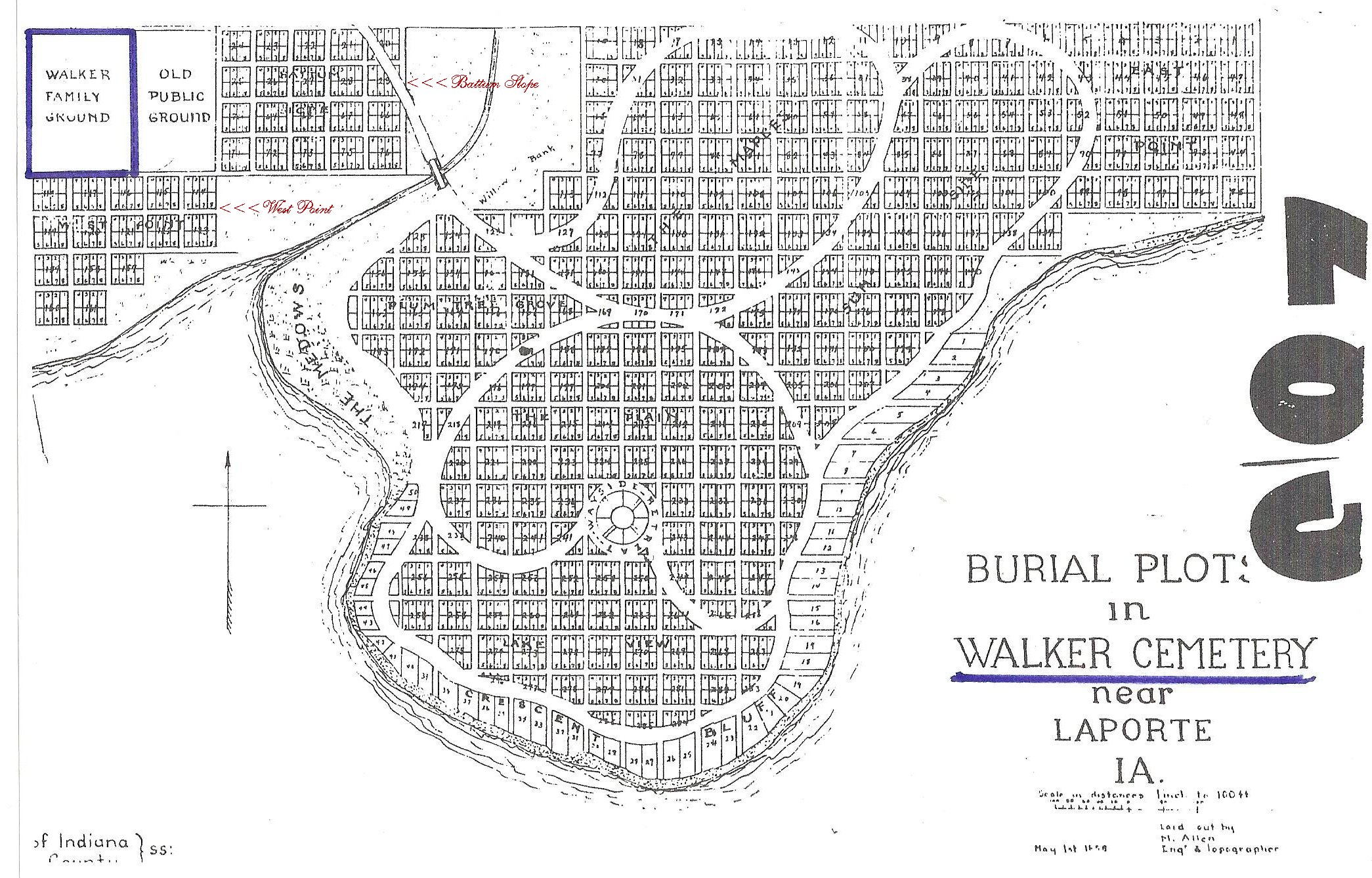
map (1950) -vs- the newer maps. The old Map, done in 1950, indicates the entry road coming off of Clement Street at the Northeast corner of Walker "A". It was later closed off, creating another burial area - The Garden of Gethsemane. This newer garden does not have the large garden monolithic sign as seen in the other gardens. It is located between Walker Section "A" to the West and Garden of Meditation to the East. (see map) The 1972 maps shows the garden areas developed on the East side of Patton Cemetery and absorbing part of "The Maples" and all of "Sum...Side"on the old map. Today a newer entrance is where McCollum and Rumely Street intersect on the West side of Patton. Recently another entry road was added on the East side of The Garden of Meditation. Its entry is at the corner of Morrison and Clement Street on the North side of the cemetery. Brady Section: To offer an additional burial area, cemetery sexton, Scott Harris created the Brady Section. This section was named after the previous sexton, Chris Brady. It is located across the cemetery road from Sacred Heart and continues to run diagonally across from the Plum Tree Grove section. We hope that anyone with individual or family burials, not listed, will contact us. Thank you... Deanna Branson West |
2013
- Google Cemetery Map with Burial Areas Noted
Use
in conjunction with our on line listings & graphs

1950's Archaic Cemetery Map Before
Gardens and Garden Numbers were Established

| Burial Areas | ||
| Walker 'A', Sacred Heart & The Maples | Walker Areas | |
| Plum Tree Grove, The Plains & Lakeview | South & East Bank & The Tiers | CBA Adults |
| CBA Infants | Wayside Retreat | Babyland |
| Garden Areas | ||
| Garden of Blessings | Garden of Devotion | Garden of Gethsemane (in progress) |
| Garden of Good Shepherd | Garden of Meditation | Garden of Memories |