GenealogyCemetery Records with photographs of headstones.
|
|
The following list is a sincere attempt to show all known graves using several different sources and periodically updated headstone photographs. There may be other graves which are unknown/unlisted due to missing, unreadable, destroyed, or broken markers.
If you have knowledge of any other graves which may not be shown here, or of any incorrect information whatsoever, I would be grateful for your assistance. Drop me an email and let me know. Please avoid however, notifying me of very recent burials that do not appear here. I will capture and incorporate these on the next scheduled cemetery update.
![]()
George Pickersgill
|
Surname |
Given Name |
Birth Date |
Death Date |
Notes & Inscriptions |
Photo# Photo |
Sect- ion |
Row |
|
? |
? |
? |
? |
Illegible. (Note: At south end of row.) |
6754 |
0 |
1 |
|
? |
? |
? |
? |
(Note: Broken marker; top missing. Between BLACK and HENNIN burials at south
end of row.) |
6891 |
0 |
5 |
|
? |
? |
? |
? |
(Note: Rough carved concrete. Best guess is: Mrs. ORIE?A.) |
6990 |
0 |
8 |
|
? |
Anna |
|
|
-- |
6925 6926 |
0 |
9 |
|
? |
? |
? |
? |
(Note: No visible carving. Betwee NOSSETT and COCKRUM burials.) |
5917 |
1 |
1 |
|
? |
? |
? |
? |
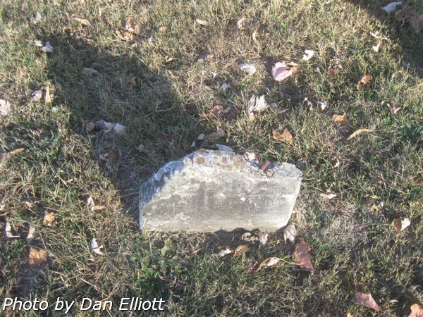
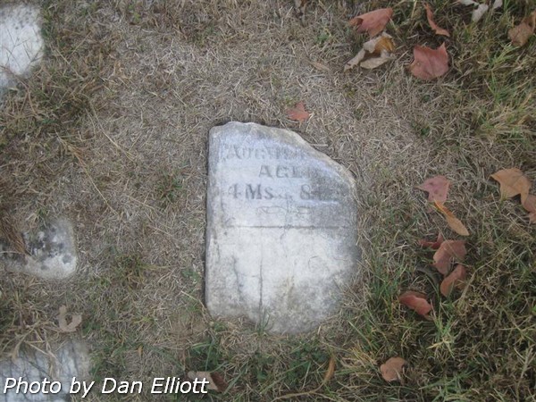
(Note: Three illegible stones at north end of row. One stone
date of death in �Aug,� Age �4 Ms. 8 Ds.) |
5998 5999 |
1 |
4 |
|
? |
? |
? |
? |
(Note: No legible carving. At south end of row.) |
6020 6021 |
1 |
4 |
|
? |
? |
? |
? |
(Note: Small stone, no visible markings. On north end of row, between BRYANT and
SHOULDERS burials.) |
6244 |
1 |
11 |
|
? |
? |
? |
? |
(Note: Rough concrete, illegible. Between FARMER and MILLER burials.) |
6958 |
2 |
6 |
|
? |
? |
? |
? |
(Note: No visible carving. Probably an infant.) |
7041 |
2 |
10 |
|
? |
? |
? |
? |
(Note: Rough concrete.) |
7043 |
2 |
10 |
|
? |
? |
? |
? |
(Note: Monument base only; between CHERRY and BILDERBACK burials.) |
4837 |
4 |
9 |
|
? |
? |
? |
? |
(Note: Base only, next to John D & Sarah A
GRIMES.) |
5137 |
4 |
14 |
|
? |
? |
? |
? |
(Note: Base for monument. Between Hubert H ROTHROCK and Billie
PHILLIPS. |
3874 |
6 |
2 |
|
? |
? |
? |
? |
(Note: Monument base only. Between Ottis DAVIS and George B GRIM,
M.D.) |
5753 |
9 |
8 |
|
? |
? |
? |
? |
(Note: Top of marker is missing. Between |
5883 |
9 |
13 |
|
? |
? |
? |
? |
(Note: Only base of monument remains Monument appears to have been removed.) |
3597 |
11 |
7 |
|
? |
? |
? |
? |
(Note: Between HENDRICKS and MOORE burials.) |
2107 |
14 |
3 |
|
? |
? |
? |
? |
(Note: Plot is immediately to the north of Vergie and Floyd E RUMBLE.) |
1246 |
14 |
3 |
|
? |
? |
? |
? |
(Note: Unmarked grave, near the south end of Row 12, immediately west of James Cochrane in Row 13.) |
1282 |
14 |
12 |
|
? |
? |
? |
? |
(Note: Base only. Monument appears to have been removed.) |
2595 |
14 |
16 |


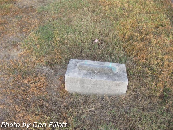


The cemetery is divided into numerical sections on the plat map (Stakes and/or concrete markers with corresponding numbers can usually be found at the corners of sections.) These numbes have been maintained for this listing. For this listing rows were numbered beginning on the west side of each section. Please be advised rows in sections 0 and 1 are somewhat irregular. See the images below for reference.
Aerial view of cemetery.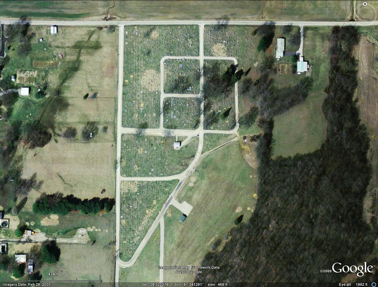 |
Section definitions used for this listing. |
5570 Original center lane entrance at north side of the cemetery. |
1881 View of cemetery from south side of Section 15. |